The Dragon of Yankee Fork: Spalding Viaduct

This is a guest post by Martha Dalke Hindman. It is an excerpt from her upcoming book, The Dragon of Yankee Fork. This is the final of three posts. See also: Devil’s Washbasins and Grave Markers.

———————

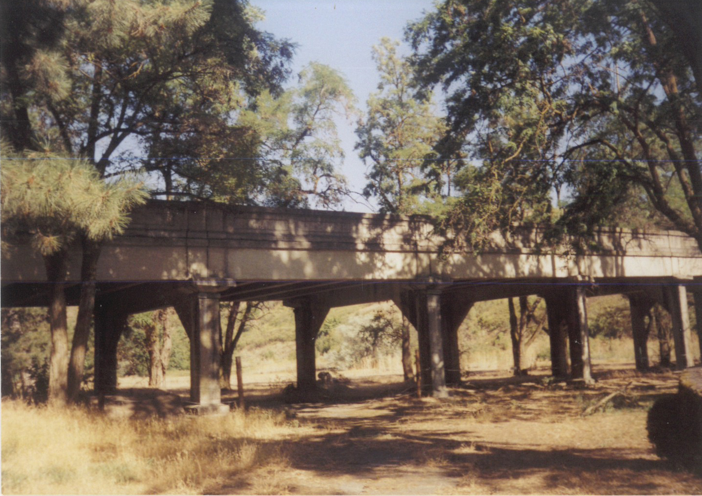
Spalding Viaduct, from the Old Mission site over the Railroad tracks
Built in 1924, steel rods, concrete construction, supporting arches and pillars.
570 feet long, 20 feet wide, a Link in U.S. Highway 95 connecting Idaho, North to South.
Today, a Chain Link Fence and Steel Gates surround the structure.

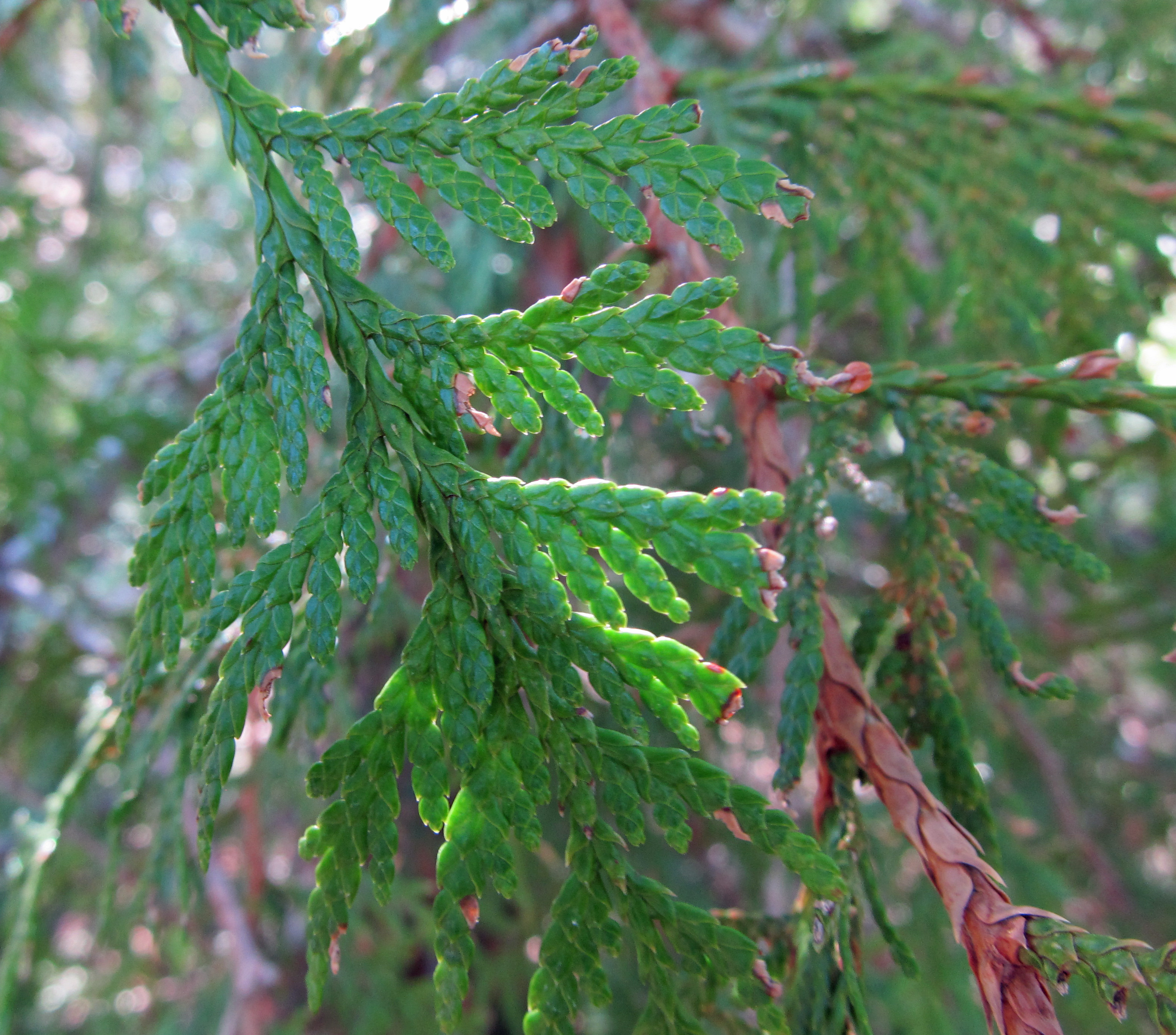
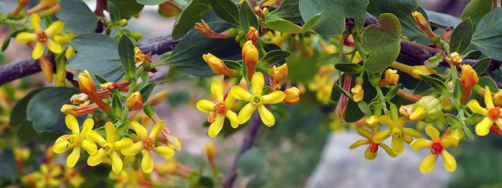
Black Locust trees, cascading white or lavender flowers
Compound leaves, dark brown seed pods.
Shade and shelter for family picnics and softball games
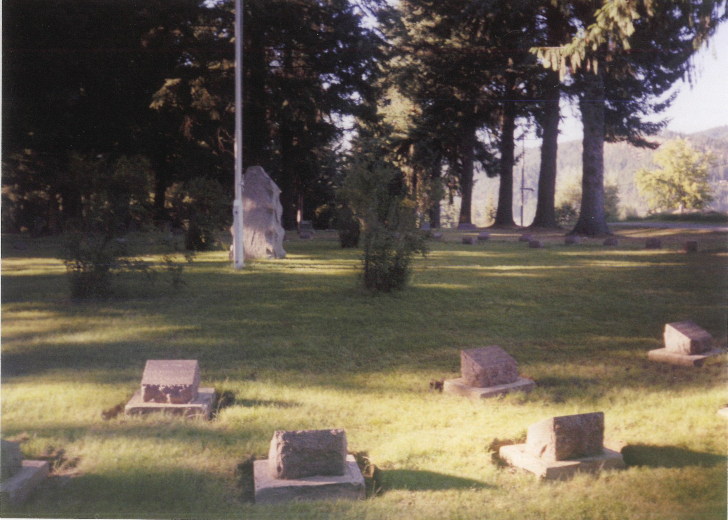
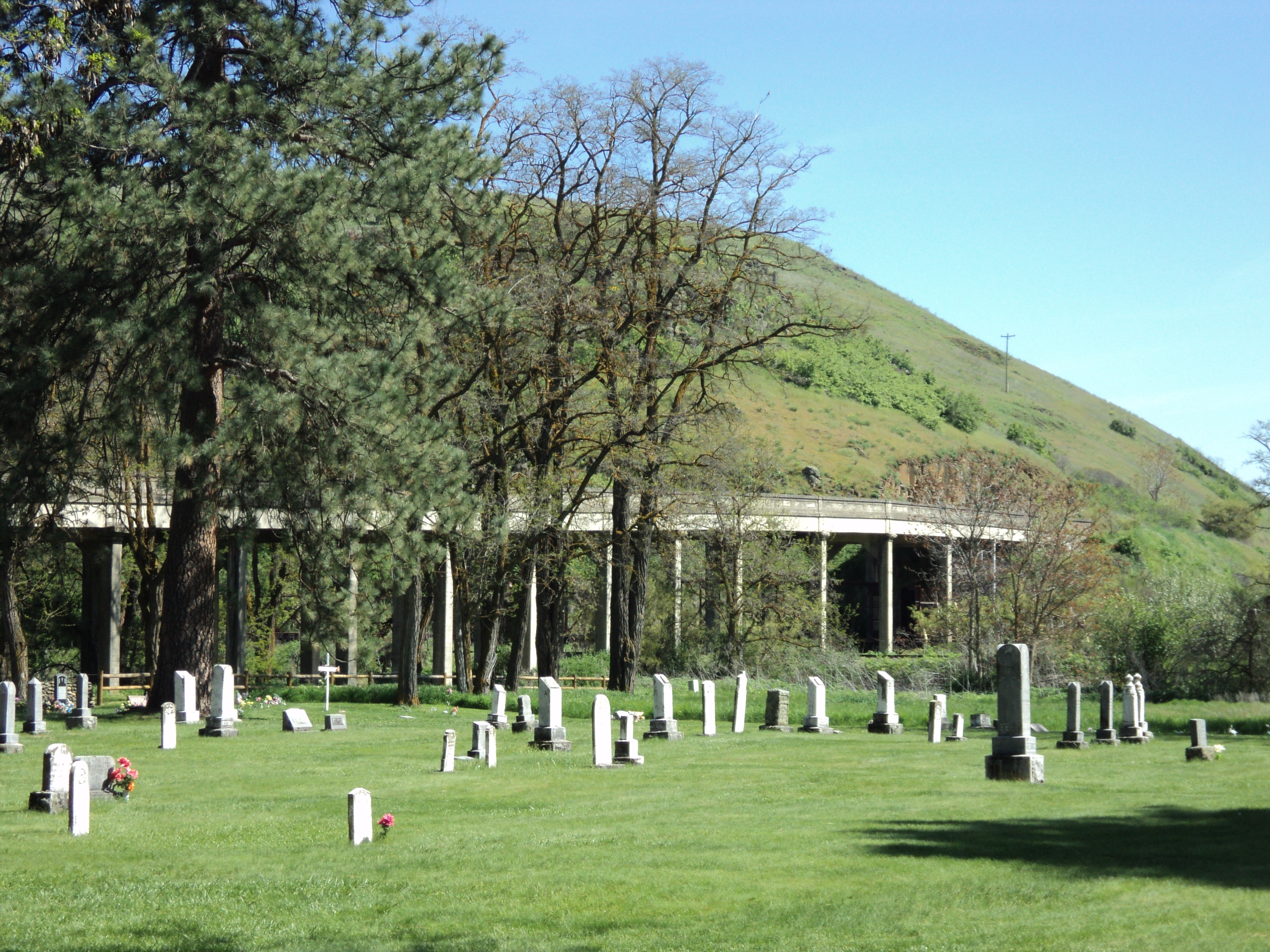
Beside the Spalding Viaduct, the Nez Perce Tribal Cemetery

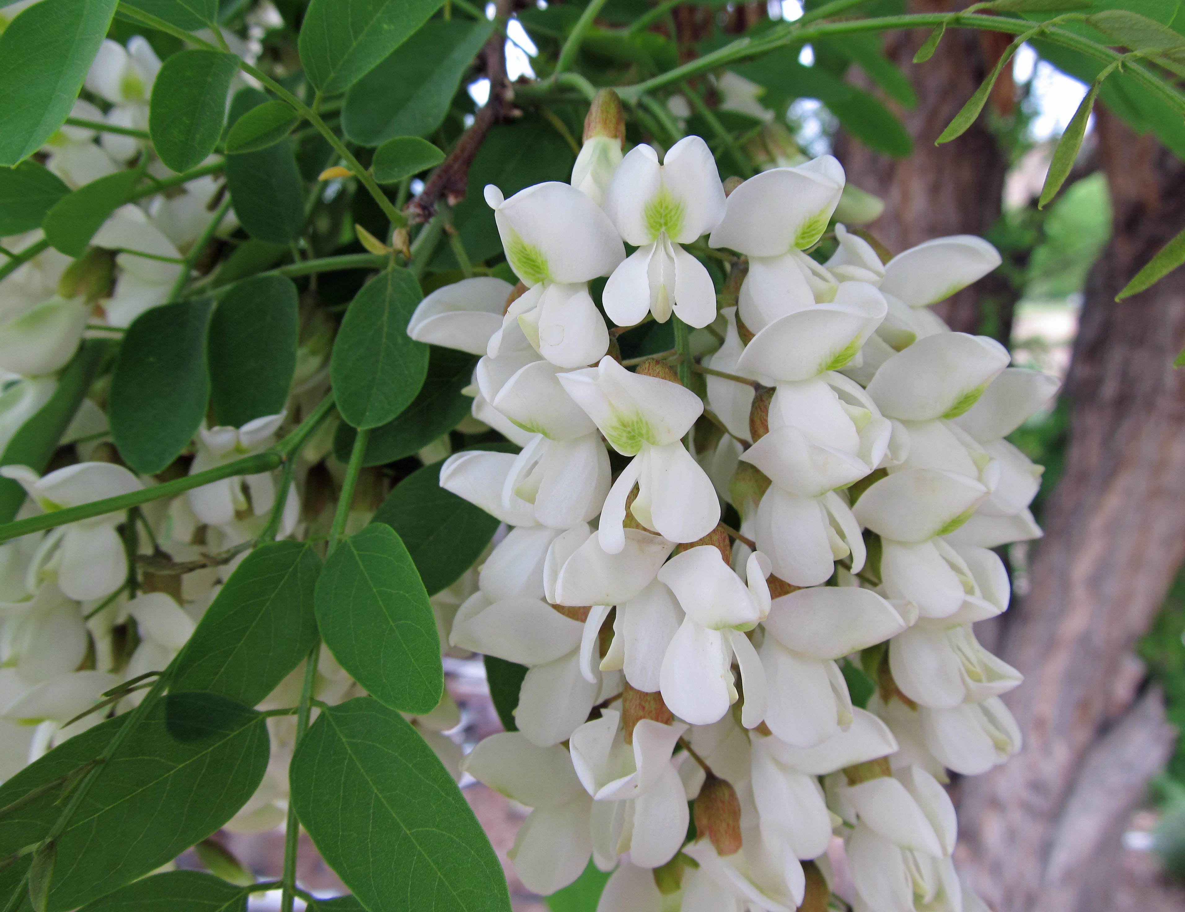
black locust (Robinia pseudoacacia)

Travel with my Dad was always an adventure. However, the Spalding Viaduct on U.S. Highway 95, was the scariest stretch of concrete highway, we ever encountered.

Dad slowed to a stop as we approached the Spalding Viaduct. A semi tractor-trailer rig was traveling north and in the center of the viaduct, leaving no room for any other vehicles. I watched as the driver carefully drove his rig down the narrow span. The driver slowed, saluted his “thanks” to us, and continued his journey. Normal traffic, backed up at either end of the viaduct, continued to their destinations. Dad and I were on our way to Boise – Idaho’s Capitol City.

Dad continued the story about how the Spalding Viaduct on U.S. Highway 95 connects the State of Idaho, North to South and South to North.

“The Spalding Viaduct is the vital link for travelers to stay within the geographical boundaries of the State of Idaho. Otherwise, to reach Boise from Lewiston, travel west and south on U. S. Highway 12 to Walla Walla, Washington, cross the Columbia River south to Umatilla, Oregon Highway 82. Outside Umatilla, connect with U.S. Highway 84 east through Southeast Oregon, across the Snake River at Ontario, Oregon and into Boise. The only other way to reach Boise from our home in Moscow, is to travel south on U.S. Highway 95 to Lewiston, turn east on U.S. Highway 12 into Hamilton, Montana. From Hamilton, south on U.S. Highway 93 through the magnificent Bitterroot Valley, to the Montana, Idaho border. U.S. Highway 15 takes you to Idaho Falls and U.S. Highway 86 into Boise. Coming from our home in Moscow, travel time to Boise would be two days. That is why the Spalding Viaduct is so vital to North-South and South-North traffic.”

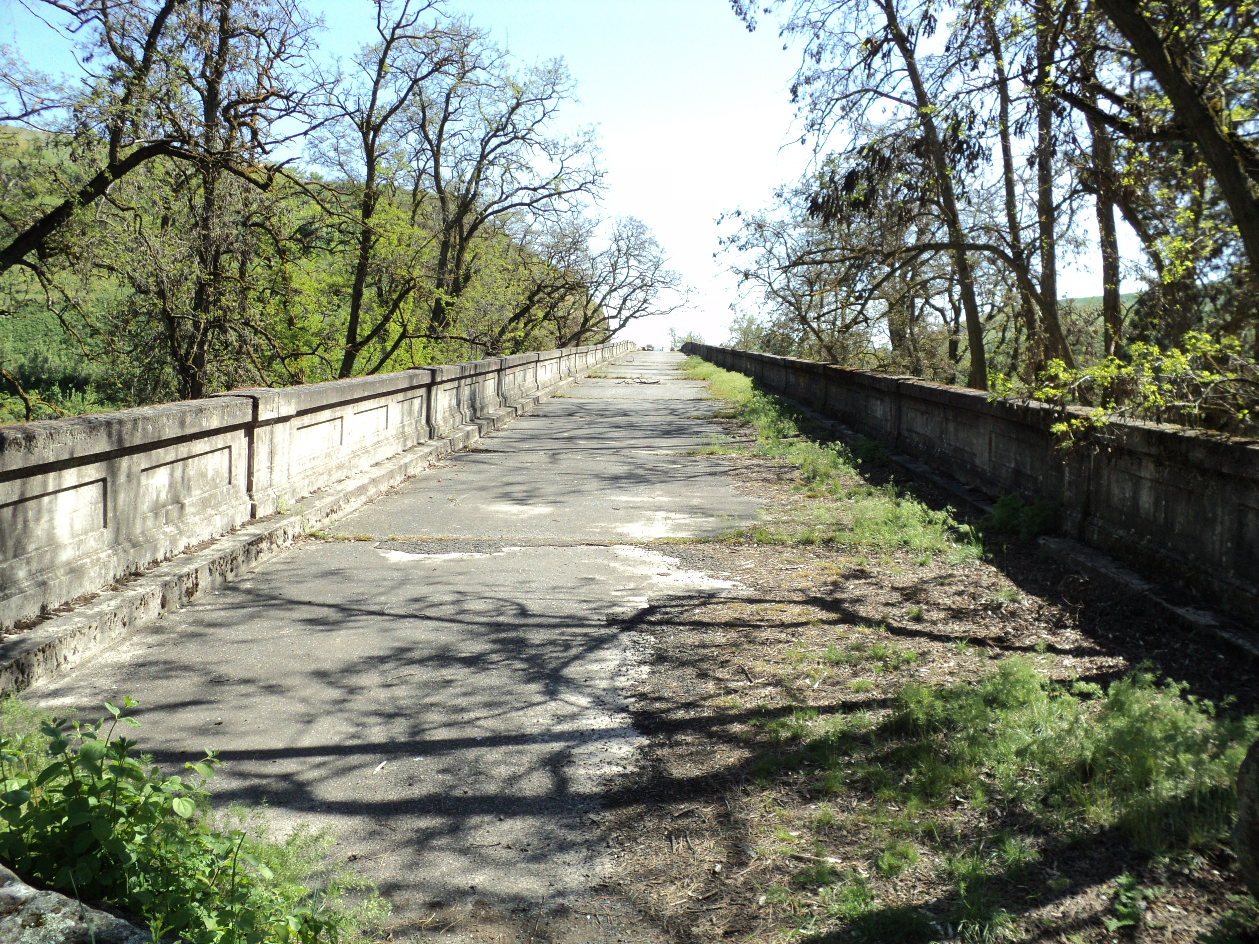
“Dad, do we change time zones before we reach Boise??”

“Yes, Martha Lee. Time zones change from Pacific Standard Time, to Mountain Standard Time when we cross the Salmon River Bridge at Riggins. Because we are traveling south, we lose one hour. Watch for a roadside park with a picnic table. Mother packed a lunch full of sandwiches, goodies and a thermos full of ice cold water. We should arrive in Boise about 7 pm. Mountain Standard Time. In the meantime, enjoy the scenery.”

“Dad, there is JUST the place for our picnic, under the shade of the black locust trees.”

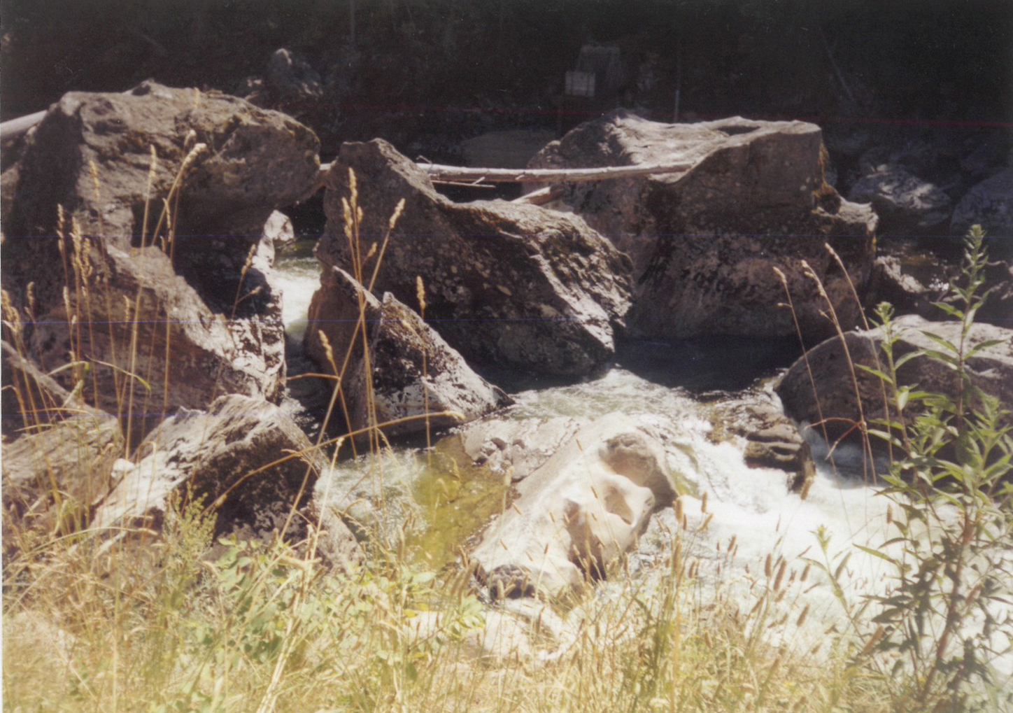
We parked our car at the picnic area next to the Spalding Viaduct. The black locust trees in bloom, a gentle breeze brought “fishy” smells from the Clearwater River, the water still high and rapid from the spring rains. The log drive was finished, only a few pieces of debris floated by.

Several families were finishing their noon meal, as we sat down at the long wooden table and unpacked our lunch. Mother had prepared peanut butter and honey sandwiches, potato salad, liverwurst slices, cheddar cheese, carrots and strawberries from our garden, chocolate chip cookies, and a large Coleman thermos of cold water. What a feast!

The afternoon sun was warm, the breeze calm, just the recipe for a game of softball. Dad batted first. A gentle swing to left field. Home Run!!

My turn to bat! I swung, missing the first ball. The second pitch, I hit, but it flew straight into the Clearwater River. The strong current carried my softball downstream. I could not catch it. End of Game!

I cried. Dad put his strong arms around my sagging shoulders. “It’s OK, Martha Lee. I’ll see to it that you have another softball. We will never know how far your old ball will travel. It may get stuck in debris along the river banks, or it may end up in the Pacific Ocean, riding the ocean currents to the shores of the Hawaiian Islands, or maybe even into Shanghai Harbor, China!”

Several days later, Dad came home with a package under his arm. With a twinkle in his eye, Dad gave me the box. I opened the shiny, square box. Inside was a new softball ready to be played with and loved just as much as the old one.

Thanks, Dad.

Additional Information:

The Spalding Viaduct is falling apart, literally. Large pieces of the concrete columns become loose and fall to the ground. This once vital link on U.S. Highway 95 is closed with steel gates and a chain link fence. Moss grows where semi trucks carrying goods and produce South to North and North to South, passenger cars and buses, traveling South to Boise and North to Canada, watched out for each other on the narrow roadway.

Modern day travelers and truck traffic continues to travel North-South and South-North on U.S. Highway 95, over a new bridge (built in 1962) across the Clearwater River to the East of the Spalding Viaduct. A new stretch of highway was constructed from the river bridge, over the railroad tracks, up the hill, and onto the Camas Prairie. U.S. Highway 95 continues south to Grangeville, Riggins, and ends at Middleton, Idaho. U.S. Highway 44 connects with U.S. Highway 84 into Boise.

Updates were made to the current bridge in 2014. Click here for more information.

———————

Poetry, personal stories, images, journal entries, recipes for Springerle, Cinnamon Rolls, Fried Cakes, “a little bit of science thrown in for good measure,” print and online resources, all define “The Dragon of Yankee Fork,” an Idaho Alphabet from A to Z. It all began on a long piece of cream colored shelf paper!

Martha Dalke Hindman’s outdoor classroom was the travel adventures she shared with her father around the State of Idaho. From dusty roads, fishing expeditions, and a keen sense of observation, learning about Idaho’s heritage gave Ms. Hindman her voice in poetry and personal short stories. She may be reached at martha20022 [at] gmail [dot] com.

Advertisement

The Dragon of Yankee Fork: Grave Markers

This is a guest post by Martha Dalke Hindman. It is an excerpt from her upcoming book, The Dragon of Yankee Fork. This is the second of three posts. See also: Devil’s Washbasins.

———————

Grave Markers preserve for the Ages, records etched in stone.
The Firefighters Circle, Woodlawn Cemetery, St. Maries, Idaho.
57 of the 94 men, who perished fighting the Great Fire of 1910
Rest together in this Sacred Space.

Sentinels towering in the late afternoon Sun,
Old growth Western Red Cedar trees,
Their fragrant, graceful boughs swaying in the breeze
Watch over the square, Red Granite stones.

western redcedar (Thuja plicata)

On a warm and breezy Wednesday afternoon in 2005, peaceful and quiet when Kaye and I visited Woodlawn Cemetery in St. Maries, Idaho. The Firefighters Circle, a tribute to the men who died fighting the Great Fire of 1910. Here, together they rest forever.

“Look carefully at the Grave Markers, Kaye.”

“Do you see the names of each firefighter and the place where he perished; Big Creek, Storm Creek, Defaut Gulch, Swamp Creek and Wallace?”

The men were buried where they had fallen. In 1912, the United States Forest Service hired an undertaking company to exhume the bodies and bring them here to Woodlawn Cemetery, to be identified by family members. The bodies identified by family members are buried in several cities in Idaho and five other states beyond Idaho’s borders. The firefighters with no family members to identify them were first generation immigrant men from Europe. Those are the fifty-seven men buried in a “circle within a circle”, facing each other, creating their own “family” here in Woodlawn Cemetery.

Firefighters’ Circle at Woodlawn Cemetery, St. Maries, Idaho in 2005

My daughter stopped for a moment, tears in her eyes. Her gaze met mine.

“Why the tears, Sweetie?” I asked.

I realized from her expression she was remembering her father’s graveside service in May, 1994. I put my arms around her and held her close. She was missing her Dad, just as much as the families of those firefighters resting together at Woodlawn Cemetery, were missing their loved ones.

The Firefighters Circle at Woodlawn Cemetery, St. Maries, Idaho was rededicated, August 20, 2010, with parades, speeches and an ongoing commitment by the men and women who help protect Idaho’s natural woodlands.

Firefighters’ Circle at Woodlawn Cemetery, St. Maries, Idaho in 2015 (via wikimedia commons)

———————

Poetry, personal stories, images, journal entries, recipes for Springerle, Cinnamon Rolls, Fried Cakes, “a little bit of science thrown in for good measure,” print and online resources, all define “The Dragon of Yankee Fork,” an Idaho Alphabet from A to Z. It all began on a long piece of cream colored shelf paper!

Martha Dalke Hindman’s outdoor classroom was the travel adventures she shared with her father around the State of Idaho. From dusty roads, fishing expeditions, and a keen sense of observation, learning about Idaho’s heritage gave Ms. Hindman her voice in poetry and personal short stories. She may be reached at martha20022 [at] gmail [dot] com.

The Dragon of Yankee Fork: Devil’s Washbasins

This is a guest post by Martha Dalke Hindman. It is an excerpt from her upcoming book, The Dragon of Yankee Fork

———————

July through September, river water is low, cold, clear.
Four huge, round washbasins appear in an ageless,
Rectangular, horizontal piece of white granite rock.
“Devil’s Washbasins,” at Selway Falls.

Cousin to the domestic Raspberry,
Thimbleberries grow along the river bank.
White blossoms, no thorns, broad indented leaves,
Red berries, a bit of sugar, delectable desert.

thimbleberry (Rubus parviflorus)

Long shadows on the dusty, winding road, from Race Creek to Selway Falls, made driving a challenge. Kaye and I stopped at Selway Falls to rest and look into “The Devil’s Washbasins.” Although the Falls are not particularly high, only 25 feet, the sound of the water cascading over timeless, granite boulders, into the river below, creates a world unto itself.

A cream colored car with Oregon license plates slowed to a stop. A man and woman stepped out. I smiled and asked if I could be of assistance.

“Can you tell us WHERE Selway Falls is,” the gentleman asked. “There is no marker.”

“Selway Falls is right here,” I explained. “Do you hear the rushing, tumbling water?”

“But, but! That is just a pile of rocks!!” The gentleman exclaimed. “We expected to see falls like Multnomah Falls near Portland, Oregon.”

“I am sorry you are so disappointed.” I said. I explained that waterfalls the height and size of Multnomah are not found in this particular part of the country. “If you care to stop at Fenn Ranger Station, I am sure the ranger on duty can give you more detailed information about the falls. You will see a large sign reading, ‘Fenn Ranger Station, Nez Perce National Forest’, as you return to the blacktop portion of the road.”

Thoroughly disillusioned and disgusted, the couple returned to their car and drove away in a cloud of dust!

“Devil’s Washbasins” is this author’s name for four giant bowls in white Granite rock at the bottom of Selway Falls on the Selway River, Nez Perce-Clearwater National Forest. The bowls created by centuries of water, can only be observed when the river water is low, usually after the 4th of July and until snow covers the forest. Observe the calm pool at the top of the falls. Enjoy the water’s music and beauty. Help to preserve its Integrity.

“Selway Falls technically is not a falls. It is called a ‘cataract.’ This occurred when the North side of the mountain slid into the river. The flow of the water found ways to continue its journey to the sea. Small pools formed, the water moved around boulders 30 feet in diameter, as well as over and under downed trees, submerged logs, smaller rocks and debris. The water level fluctuates from 23 feet to 32 feet, dependent upon the winter’s snowpack in the mountains and the spring run off.“ [Columbia River Fisheries Development Program, February 1, 1967, STATE OF IDAHO, Fish and Game Department, John R. Woodworth, Director. Pages not numbered.]

A FOREST CHASM

I looked into the Chasm

Of Selway Falls

Late one Summer afternoon.

Four irregular washbasins

In one piece of Granite

Basked In the Summer Sun

Waiting for—

The Seasons to change

Fall, Winter, Spring.

Who comes to drink

From these four washbasins?

Only the River

And the forest

Animals know.

We humans can

Only Imagine!

Resources:

———————

Poetry, personal stories, images, journal entries, recipes for Springerle, Cinnamon Rolls, Fried Cakes, “a little bit of science thrown in for good measure,” print and online resources, all define “The Dragon of Yankee Fork,” an Idaho Alphabet from A to Z. It all began on a long piece of cream colored shelf paper!

Martha Dalke Hindman’s outdoor classroom was the travel adventures she shared with her father around the State of Idaho. From dusty roads, fishing expeditions, and a keen sense of observation, learning about Idaho’s Heritage gave Ms. Hindman her voice in poetry and personal short stories. She may be reached at martha20022 [at] gmail [dot] com.